United States / Pacific / Washington
Pierce County, Washington
Health: Wastewater site 2045: COVID-19 (SARS-CoV-2) level 23.22, above the highest weekly level on record for this site (22.7). No official warning is in effect. Every kind of source we watch here answered.
Radar
RainViewer (NOAA NEXRAD) · the past two hoursAir Traffic
live · adsb.lol, adsb.fiRoad Traffic
speeds, incidents, closures and work zones · camerasRivers And Streams
27 USGS gaugesFrom The Archive
historic photos of this county2 historic photos · 1930s–1960s

Photos from Archive & Atlas’ The Archive, an Atlas Data Industries service, are placed in this county by where each was taken; each is shown whole and linked to its record. New photos appear here as The Archive adds them.
What Each Status Rests On
every topic · open one for its recordsWhat Each Status Rests On
Open a topic for its recordsHealthUnusual For HereWastewater site 2045: COVID-19 (SARS-CoV-2) level 23.22, above the highest weekly level on record for this site (22.7).
Health
Unusual For HereWastewater site 2045: COVID-19 (SARS-CoV-2) level 23.22, above the highest weekly level on record for this site (22.7).
- Wastewater site 2045: COVID-19 (SARS-CoV-2) level 23.22 Record · above the highest weekly level on record for this site (22.7) · CDC National Wastewater Surveillance System · Oct 17, 5:00 PM PDT
- Wastewater site 2053: COVID-19 (SARS-CoV-2) level 9.18 · within the usual weekly level for this site · CDC National Wastewater Surveillance System · Oct 17, 5:00 PM PDT
- Wastewater site 2045: influenza A level 1 · within the usual weekly level for this site · CDC National Wastewater Surveillance System · Oct 17, 5:00 PM PDT
- Wastewater site 2053: influenza A level 1 · within the usual weekly level for this site · CDC National Wastewater Surveillance System · Oct 17, 5:00 PM PDT
- Wastewater site 2045: RSV level 1 · not enough history for this site to say what is usual · CDC National Wastewater Surveillance System · Oct 17, 5:00 PM PDT
More (1)
- Wastewater site 2053: RSV level 1 · not enough history for this site to say what is usual · CDC National Wastewater Surveillance System · Oct 17, 5:00 PM PDT
- CDC wastewater data for viral activity level (SARS-CoV-2, influenza A, RSV): 24 entries for this county · CDC National Wastewater Surveillance System · read 13 h ago
- CDC wastewater data for measles: 8 entries for this county · CDC National Wastewater Surveillance System · read 14 h ago
- CDC wastewater data for avian influenza A (H5): 8 entries for this county · CDC National Wastewater Surveillance System · read 13 h ago
- CDC wastewater data for SARS-CoV-2: 6 entries for this county · CDC National Wastewater Surveillance System · read 14 h ago
- CDC wastewater data for RSV: 6 entries for this county · CDC National Wastewater Surveillance System · read 13 h ago
- CDC wastewater data for mpox: 5 entries for this county · CDC National Wastewater Surveillance System · read 13 h ago
- CDC wastewater data for influenza A: 5 entries for this county · CDC National Wastewater Surveillance System · read 13 h ago
Entries are what each state or utility feed lists for this county: incidents, closures or outage areas. We count them; we do not reproduce them.
The sources behind this status (7)
Sources that cover this county by name, and state or national sources that have placed records on it in the last week, by their latest read. A state-wide source that has placed nothing here is not listed.
Answering with records (7)
- CDC National Wastewater Surveillance System: CDC wastewater data for SARS-CoV-2 · 6 records placed on this county in its latest read · read 14 h ago
- CDC National Wastewater Surveillance System: CDC wastewater data for measles · 8 records placed on this county in its latest read · read 14 h ago
- CDC National Wastewater Surveillance System: CDC wastewater data for mpox · 5 records placed on this county in its latest read · read 13 h ago
- CDC National Wastewater Surveillance System: CDC wastewater data for viral activity level (SARS-CoV-2, influenza A, RSV) · 24 records placed on this county in its latest read · read 13 h ago
- CDC National Wastewater Surveillance System: CDC wastewater data for RSV · 6 records placed on this county in its latest read · read 13 h ago
- CDC National Wastewater Surveillance System: CDC wastewater data for avian influenza A (H5) · 8 records placed on this county in its latest read · read 13 h ago
- CDC National Wastewater Surveillance System: CDC wastewater data for influenza A · 5 records placed on this county in its latest read · read 13 h ago
SafetyActive4 reports in the last 24 hours from 1 source.
Safety
Active4 reports in the last 24 hours from 1 source.
- Dataset Updated: WDFW - Tacoma Power Hatchery Adults · Washington Technology Solutions · 9 h ago
- Dataset Updated: WDFW - Tacoma Power Cowlitz Hatchery Adult Plants · Washington Technology Solutions · 9 h ago
- Dataset Updated: WDFW - Tacoma Power Cowlitz SGS Counts · Washington Technology Solutions · 9 h ago
- Dataset Updated: WDFW - Tacoma Power Cowlitz Weirs · Washington Technology Solutions · 9 h ago
The sources behind this status (2)
Sources that cover this county by name, and state or national sources that have placed records on it in the last week, by their latest read. A state-wide source that has placed nothing here is not listed.
Answered, nothing current (2)
- Washington Technology Solutions · nothing placed on this county in its latest read · read 1 h ago
- Washington Technology Solutions · nothing placed on this county in its latest read · read 33 min ago
WeatherQuiet50 river gauges reading now, shown against their usual but not yet judged.
Weather
Quiet50 river gauges reading now, shown against their usual but not yet judged.
Official Warnings
No official warning is in effect here right now.
- Puyallup River Near Orting, WA: water level 6.17 ft · above the highest October monthly average on record for this gauge (5.65 ft) · U.S. Geological Survey · 1 h ago
- Leach Creek Near Fircrest, WA: water level 1.86 ft · above the highest October monthly average on record for this gauge (1.27 ft) · U.S. Geological Survey · 1 h ago
- Nisqually River Near National, WA: flow 179 ft³/s · below the lowest October monthly average on record for this gauge (195 ft³/s) · U.S. Geological Survey · 1 h ago
- Huckleberry Creek Near Greenwater, WA: flow 27.9 ft³/s · below the lowest October monthly average on record for this gauge (28 ft³/s) · U.S. Geological Survey · 1 h ago
- Puyallup River At Alderton, WA: water level 45.91 ft · below the lowest October monthly average on record for this gauge (45.95 ft) · U.S. Geological Survey · 1 h ago
More (45)
- Flett Creek At Tacoma, WA: flow 16.2 ft³/s · this gauge’s October monthly average is usually below 10.06 ft³/s · U.S. Geological Survey · 1 h ago
- Leach Creek Near Fircrest, WA: flow 5.84 ft³/s · this gauge’s October monthly average is usually below 3.67 ft³/s · U.S. Geological Survey · 1 h ago
- Leach Creek At Meadow Park Gc At University Place, WA: flow 12.3 ft³/s · this gauge’s October monthly average is usually below 10.62 ft³/s · U.S. Geological Survey · 2 h ago
- Carbon River Near Fairfax, WA: water level 5.77 ft · this gauge’s October monthly average is usually above 6.04 ft · U.S. Geological Survey · 1 h ago
- Puyallup River Near Electron, WA: flow 165 ft³/s · this gauge’s October monthly average is usually above 191 ft³/s · U.S. Geological Survey · 2 h ago
- Puyallup River Near Orting, WA: flow 224 ft³/s · within the usual October monthly average for this gauge · U.S. Geological Survey · 1 h ago
- Chambers Creek Bl Leach Creek Near Steilacoom, WA: flow 60.5 ft³/s · within the usual October monthly average for this gauge · U.S. Geological Survey · 1 h ago
- Carbon River Near Fairfax, WA: flow 122 ft³/s · within the usual October monthly average for this gauge · U.S. Geological Survey · 1 h ago
- White River Flume At Buckley, WA: flow 20.9 ft³/s · within the usual October monthly average for this gauge · U.S. Geological Survey · 1 h ago
- Nisqually River Near National, WA: water level 4.14 ft · within the usual October monthly average for this gauge · U.S. Geological Survey · 1 h ago
- Chambers Creek Bl Leach Creek Near Steilacoom, WA: water level 1.79 ft · within the usual October monthly average for this gauge · U.S. Geological Survey · 1 h ago
- Mashel River Near La Grande, WA: flow 72.1 ft³/s · within the usual October monthly average for this gauge · U.S. Geological Survey · 1 h ago
- South Prairie Creek At South Prairie, WA: flow 73.9 ft³/s · within the usual October monthly average for this gauge · U.S. Geological Survey · 1 h ago
- Puyallup River At Alderton, WA: flow 608 ft³/s · within the usual October monthly average for this gauge · U.S. Geological Survey · 1 h ago
- Lake Tapps Diversion At Dieringer, WA: flow 22.7 ft³/s · within the usual October monthly average for this gauge · U.S. Geological Survey · 1 h ago
- Puyallup River At Puyallup, WA: flow 1,240 ft³/s · within the usual October monthly average for this gauge · U.S. Geological Survey · 1 h ago
- Mashel River Near La Grande, WA: water level 2.49 ft · within the usual October monthly average for this gauge · U.S. Geological Survey · 1 h ago
- Flett Creek At Tacoma, WA: water level 8.9 ft · within the usual October monthly average for this gauge · U.S. Geological Survey · 1 h ago
- South Prairie Creek At South Prairie, WA: water level 24.87 ft · within the usual October monthly average for this gauge · U.S. Geological Survey · 1 h ago
- Lake Tapps Diversion At Dieringer, WA: water level 5.76 ft · within the usual October monthly average for this gauge · U.S. Geological Survey · 1 h ago
- Puyallup River At Puyallup, WA: water level 10.5 ft · within the usual October monthly average for this gauge · U.S. Geological Survey · 1 h ago
- Ohop Creek Near Eatonville, WA: flow 15 ft³/s · within the usual October monthly average for this gauge · U.S. Geological Survey · 2 h ago
- Puyallup River At East Main Bridge At Puyallup, WA: flow 605 ft³/s · within the usual October monthly average for this gauge · U.S. Geological Survey · 2 h ago
- Clearwater River Near Buckley, WA: flow 21.8 ft³/s · within the usual October monthly average for this gauge · U.S. Geological Survey · 2 h ago
- Gauge 12099200: flow 390 ft³/s · within the usual October monthly average for this gauge · U.S. Geological Survey · 2 h ago
- Puyallup River At 5th Street Bridge At Puyallup, WA: flow 1,260 ft³/s · within the usual October monthly average for this gauge · U.S. Geological Survey · 2 h ago
- Clarks Creek At Stewart Avenue Near Puyallup, WA: flow 52.4 ft³/s · within the usual October monthly average for this gauge · U.S. Geological Survey · 2 h ago
- Ohop Creek Near Eatonville, WA: water level 1.82 ft · within the usual October monthly average for this gauge · U.S. Geological Survey · 2 h ago
- Gauge 12099200: water level 40.3 ft · within the usual October monthly average for this gauge · U.S. Geological Survey · 2 h ago
- White River Near Sumner, WA: water level 59.87 ft · within the usual October monthly average for this gauge · U.S. Geological Survey · 2 h ago
- Lake Tapps Near Sumner, WA: water level 540 ft · within the usual October monthly average for this gauge · U.S. Geological Survey · 2 h ago
- White River At 24th Street East At Dieringer, WA: water level 41.45 ft · within the usual October monthly average for this gauge · U.S. Geological Survey · 2 h ago
- Huge Creek Near Wauna, WA: flow 5.48 ft³/s · within the usual October monthly average for this gauge · U.S. Geological Survey · 2 h ago
- Clover Creek Near Tillicum, WA: flow 0 ft³/s · within the usual October monthly average for this gauge · U.S. Geological Survey · 2 h ago
- Huge Creek Near Wauna, WA: water level 1.27 ft · within the usual October monthly average for this gauge · U.S. Geological Survey · 2 h ago
- Clover Creek Near Tillicum, WA: water level 13.55 ft · within the usual October monthly average for this gauge · U.S. Geological Survey · 2 h ago
- Puyallup River Near Electron, WA: water level 3.27 ft · within the usual October monthly average for this gauge · U.S. Geological Survey · 2 h ago
- Gauge 12097850: water level 47.9 ft · not enough history for this gauge to say what is usual · U.S. Geological Survey · 1 h ago
- Gauge 12098920: water level 1.69 ft · not enough history for this gauge to say what is usual · U.S. Geological Survey · 1 h ago
- Gauge 12096865: water level 36.83 ft · not enough history for this gauge to say what is usual · U.S. Geological Survey · 1 h ago
- Gauge 12091290: water level 0.27 ft · not enough history for this gauge to say what is usual · U.S. Geological Survey · 2 h ago
- Gauge 12096505: water level 32.09 ft · not enough history for this gauge to say what is usual · U.S. Geological Survey · 2 h ago
- Gauge 12097820: water level 21.95 ft · not enough history for this gauge to say what is usual · U.S. Geological Survey · 2 h ago
- Gauge 12101470: water level 18.06 ft · not enough history for this gauge to say what is usual · U.S. Geological Survey · 2 h ago
- Gauge 12102078: water level 22 ft · not enough history for this gauge to say what is usual · U.S. Geological Survey · 2 h ago
River levels are shown against their usual, but not yet judged. A gauge’s usual here is its range of October monthly averages; the reading is the latest 15-minute value, which a passing rain or dry spell can carry outside that range. So no river gauge makes this county Unusual For Here until we compare each day with the same day’s history.
A gauge’s usual is its range of October monthly averages over its record (USGS).
- USGS daily mean streamflow and gage height - Washington: 79 entries for this county · U.S. Geological Survey · read 9 h ago
Entries are what each state or utility feed lists for this county: incidents, closures or outage areas. We count them; we do not reproduce them.
The sources behind this status (13)
Sources that cover this county by name, and state or national sources that have placed records on it in the last week, by their latest read. A state-wide source that has placed nothing here is not listed.
Answering with records (2)
- U.S. Geological Survey: USGS daily mean streamflow and gage height - Washington · 79 records placed on this county in its latest read · read 9 h ago
- University of Puget Sound · newest record Oct 26, 9:55 AM PDT · read 17 h ago
Answered, nothing current (11)
- Educational Service District 112 · nothing placed on this county in its latest read · read 17 h ago
- Kahlotus School District · nothing placed on this county in its latest read · read Oct 22, 7:34 AM PDT
- La Center School District · nothing placed on this county in its latest read · read 17 h ago
- Lumen Public School · nothing placed on this county in its latest read · read 17 h ago
- Lumen Public School · nothing placed on this county in its latest read · read 17 h ago
- National Weather Service: NWS active alerts · nothing placed on this county in its latest read · read 2 min ago
- Office of the Governor (Sch for Blind) · nothing placed on this county in its latest read · read 14 h ago
- Orondo School District · nothing placed on this county in its latest read · read 26 min ago
- Riverview School District · nothing placed on this county in its latest read · read 11 min ago
- Stehekin School District · nothing placed on this county in its latest read · read 17 h ago
- Washington Military Department · nothing placed on this county in its latest read · read 17 h ago
Roads And TransitQuiet17 reports in the last 6 hours, none published as an event.
Roads And Transit
Quiet17 reports in the last 6 hours, none published as an event.
- 3A Lakewood SR512-JBLM Main Gate (SB) · Washington State Department of Transportation · 1 h ago
- 4A Lakewood SR512-Tacoma (NB) · Washington State Department of Transportation · 1 h ago
- SR 7 / SR 706 Interchange (Elbe) at mp 16.79 · Washington State Department of Transportation · 1 h ago
- Tacoma Narrows Bridge on SR 16 at mp 5 · Washington State Department of Transportation · 1 h ago
- Puyallup River Bridge on I-5 at mp 135.28 · Washington State Department of Transportation · 1 h ago
More (17)
- C St SW in Auburn on SR 18 at mp 3.68 · Washington State Department of Transportation · 1 h ago
- Puyallup River Bridge on I-5 at mp 135.28 · Washington State Department of Transportation · 1 h ago
- Tacoma Narrows Bridge on SR 16 at mp 5 · Washington State Department of Transportation · 1 h ago
- C St SW in Auburn on SR 18 at mp 3.68 · Washington State Department of Transportation · 1 h ago
- 3A Lakewood SR512-JBLM Main Gate (SB) · Washington State Department of Transportation · 3 h ago
- 4A Lakewood SR512-Tacoma (NB) · Washington State Department of Transportation · 3 h ago
- Tacoma Maint · Washington State Department of Transportation · 4 h ago
- S Tacoma Way · Washington State Department of Transportation · 4 h ago
- S Tacoma Way · Washington State Department of Transportation · 4 h ago
- Tacoma Maint · Washington State Department of Transportation · 4 h ago
- Pacific Ave · Washington State Department of Transportation · 4 h ago
- Pacific Ave · Washington State Department of Transportation · 4 h ago
- Auburn Municipal Airport West · Washington State Department of Transportation · 7 h ago
- Auburn Municipal Airport East · Washington State Department of Transportation · 7 h ago
- Auburn Municipal Airport South · Washington State Department of Transportation · 7 h ago
- Auburn Municipal Airport North · Washington State Department of Transportation · 7 h ago
- Wind Advisory on SR 16 both directions at milepost 7.8 for the Tacoma Narrows Bridge continuing at 2:35 pm on October 28, 2026 until further notice. · Washington State Department of Transportation · 16 h ago Published event
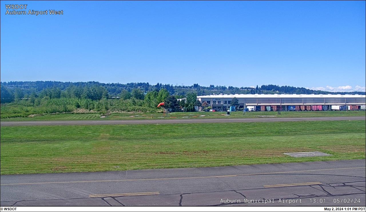
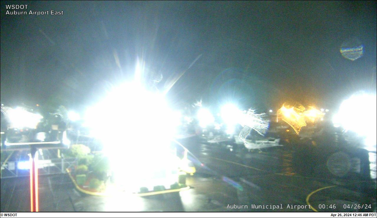
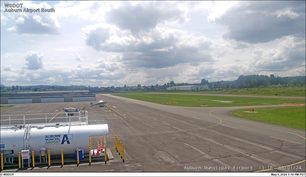
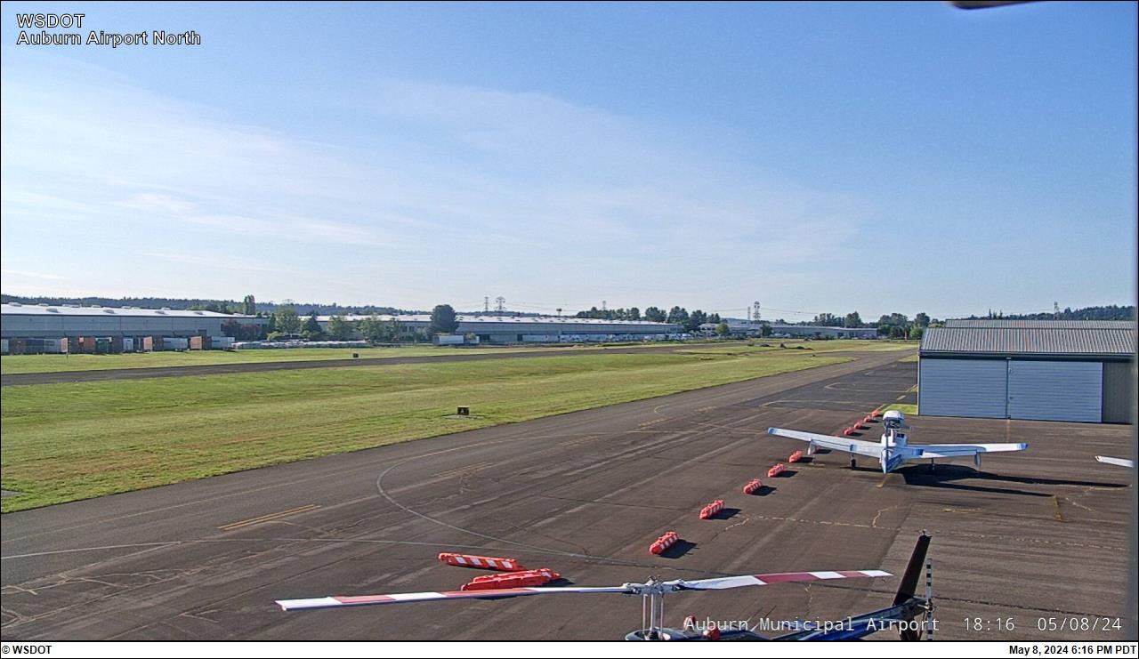
The sources behind this status (21)
Sources that cover this county by name, and state or national sources that have placed records on it in the last week, by their latest read. A state-wide source that has placed nothing here is not listed.
Answering with records (9)
- City of Seattle - Streetcar: City of Seattle - Streetcar GTFS-RT vehicle positions · newest record Oct 29, 7:13 AM PDT · read 18 min ago
- City of Seattle - Streetcar: City of Seattle - Streetcar GTFS-RT trip updates · newest record Oct 29, 7:15 AM PDT · read 16 min ago
- Pierce Transit: Pierce Transit GTFS-RT trip updates · newest record Oct 29, 7:16 AM PDT · read 16 min ago
- Pierce Transit: Pierce Transit GTFS-RT vehicle positions · newest record Oct 29, 7:26 AM PDT · read 6 min ago
- Pierce Transit: Pierce Transit GTFS-RT service alerts · newest record Oct 29, 7:30 AM PDT · read 2 min ago
- Sound Transit: Sound Transit GTFS-RT trip updates · newest record Oct 29, 7:25 AM PDT · read 7 min ago
- Sound Transit: Sound Transit GTFS-RT service alerts · newest record Oct 29, 7:25 AM PDT · read 7 min ago
- Sound Transit: Sound Transit GTFS-RT vehicle positions · newest record Oct 29, 7:25 AM PDT · read 7 min ago
- Washington State DOT: WZDx 4.2 work zones (wsdot) · 20 records placed on this county in its latest read · read 7 min ago
Answered, nothing current (12)
- City of Seattle - Streetcar: City of Seattle - Streetcar GTFS-RT service alerts · no records · read 4 min ago
- Washington State Department of Transportation · nothing placed on this county in its latest read · read 1 h ago
- Washington State Department of Transportation · nothing placed on this county in its latest read · read 1 h ago
- Washington State Department of Transportation · nothing placed on this county in its latest read · read 1 h ago
- Washington State Department of Transportation · nothing placed on this county in its latest read · read 10 h ago
- Washington State Department of Transportation · nothing placed on this county in its latest read · read 4 h ago
- Washington State Department of Transportation · nothing placed on this county in its latest read · read 4 h ago
- Washington State Department of Transportation · nothing placed on this county in its latest read · read 3 h ago
- Washington State Department of Transportation · nothing placed on this county in its latest read · read 4 min ago
- Washington State Department of Transportation · nothing placed on this county in its latest read · read 1 h ago
- Washington State Department of Transportation · nothing placed on this county in its latest read · read 1 h ago
- Washington State Department of Transportation · nothing placed on this county in its latest read · read 7 h ago
GovernmentQuiet10 reports in the last 24 hours, none published as an event.
Government
Quiet10 reports in the last 24 hours, none published as an event.
Coming Up
No meeting is on an agenda we read for the next seven days.
- Cookies With Mrs. Claus · Puyallup city · 9 h ago Not Yet Confirmed
- Breakfast With Santa · Puyallup city · 9 h ago Not Yet Confirmed
- Pictures With Santa · Puyallup city · 9 h ago Not Yet Confirmed
- Christmas Tree Lighting Ceremony · Puyallup city · 9 h ago Not Yet Confirmed
- Santa Paws · Puyallup city · 9 h ago Not Yet Confirmed
More (5)
- Check on Jury Duty · Puyallup city · 15 h ago Not Yet Confirmed
- Phase 2 | Zoning Code and Map Amendments · Puyallup city · 20 h ago Not Yet Confirmed
- APPENDICES · Puyallup city · 20 h ago Not Yet Confirmed
- Agendas, Minutes, and Videos · Puyallup city · 21 h ago Not Yet Confirmed
- Community Survey · Puyallup city · 21 h ago Not Yet Confirmed
The sources behind this status (35)
Sources that cover this county by name, and state or national sources that have placed records on it in the last week, by their latest read. A state-wide source that has placed nothing here is not listed.
Answering with records (5)
- Lakewood city: Lakewood city RSS · newest record Oct 27, 4:38 AM PDT · read 9 h ago
- Puyallup city · newest record Oct 28, 10:21 PM PDT · read 4 h ago
- Puyallup city · newest record Oct 14, 4:50 PM PDT · read Oct 21, 11:50 PM PDT
- Tacoma city · newest record Oct 27, 6:07 PM PDT · read 34 min ago
- University Place city · newest record Oct 19, 10:23 AM PDT · read 3 min ago
Answered, nothing current (17)
- Confederated Tribes and Bands of the Yakama Nation: Confederated Tribes and Bands of the Yakama Nation published feed · nothing placed on this county in its latest read · read Oct 27, 9:37 PM PDT
- Confederated Tribes of the Chehalis Reservation · nothing placed on this county in its latest read · read Oct 23, 7:21 AM PDT
- Cowlitz Indian Tribe · nothing placed on this county in its latest read · read 14 h ago
- Hoh Indian Tribe: Hoh Indian Tribe published feed · nothing placed on this county in its latest read · read 8 h ago
- Jamestown S'Klallam Tribe: Jamestown S'Klallam Tribe published feed · nothing placed on this county in its latest read · read Oct 22, 9:26 PM PDT
- Lower Elwha Tribal Community: Lower Elwha Tribal Community published feed · nothing placed on this county in its latest read · read 9 h ago
- Makah Indian Tribe of the Makah Indian Reservation: Makah Indian Tribe of the Makah Indian Reservation published feed · nothing placed on this county in its latest read · read 8 h ago
- Nooksack Indian Tribe: Nooksack Indian Tribe published feed · nothing placed on this county in its latest read · read 9 h ago
- Port Gamble S'Klallam Tribe: Port Gamble S'Klallam Tribe published feed · nothing placed on this county in its latest read · read 9 h ago
- Puyallup city · no records · read 10 min ago
- Quileute Tribe of the Quileute Reservation: Quileute Tribe of the Quileute Reservation published feed · nothing placed on this county in its latest read · read 9 h ago
- Skokomish Indian Tribe: Skokomish Indian Tribe published feed · nothing placed on this county in its latest read · read 9 h ago
- Spokane Tribe of the Spokane Reservation: Spokane Tribe of the Spokane Reservation published feed · nothing placed on this county in its latest read · read 3 min ago
- Squaxin Island Tribe of the Squaxin Island Reservation: Squaxin Island Tribe of the Squaxin Island Reservation published feed · nothing placed on this county in its latest read · read 9 h ago
- Stillaguamish Tribe of Indians of Washington: Stillaguamish Tribe of Indians of Washington published feed · nothing placed on this county in its latest read · read 9 h ago
- Suquamish Indian Tribe of the Port Madison Reservation: Suquamish Indian Tribe of the Port Madison Reservation published feed · nothing placed on this county in its latest read · read 8 h ago
- Upper Skagit Indian Tribe: Upper Skagit Indian Tribe published feed · nothing placed on this county in its latest read · read Oct 27, 9:37 PM PDT
Not current (13)
- Auburn city: Auburn city City of Auburn News - What's New · no records · read 3 h ago
- Auburn city: Auburn city RSS Feed · no records · read 3 h ago
- Lakewood city · newest record Oct 5, 2:24 PM PDT · read 14 h ago
- Pierce County government: Agenda Center - All · no records · read 9 h ago
- Pierce County government: Blog - All · no records · read Oct 28, 1:22 AM PDT
- Pierce County government: Alert Center - All · no records · read 10 min ago
- Pierce County government: News Flash - All · no records · read Oct 21, 10:32 PM PDT
- Pierce County government: Alert Center - All-Site Alert · no records · read 3 min ago
- Pierce County government: Calendar - All · no records · read 9 h ago
- Pierce County government: News Flash - All News · no records · read 15 h ago
- Puyallup city · no records · read Oct 21, 11:52 PM PDT
- University Place city · no records · read 19 h ago
- University Place city · no records · read Oct 27, 8:41 PM PDT
Local NewsQuiet1 report in the last 6 hours, none published as an event.
Local News
Quiet1 report in the last 6 hours, none published as an event.
- Armed suspects rob Lakewood jewelry store, smash door to escape · KIRO 7 (CBS) · 1 h ago Published event
- Lakewood School District · KGMI · 7 h ago Not Yet Confirmed
- Lakewood police search for broad daylight jewelry thieves armed with guns, axes · KING 5 (NBC) · 9 h ago Published event
- Pierce County ferry service restored to WA's Anderson Island after outage · KCPQ (FOX 13 Seattle) · 13 h ago Published event
- City seeks consultant for Masonic Lodge assessment · Gig Harbor Now · 15 h ago Not Yet Confirmed
More (5)
- School district task force recommends replacing Peninsula, Gig Harbor high schools · Gig Harbor Now · 15 h ago Not Yet Confirmed
- Two charged after woman reportedly escapes Pierce County home while kidnappers argued · KING 5 (NBC) · 16 h ago Not Yet Confirmed
- Man, two teens charged after gunfire hits Lakewood apartment with baby inside · KING 5 (NBC) · 18 h ago Not Yet Confirmed
- Explosion reported before garage fire in Spanaway · KING 5 (NBC) · 18 h ago Not Yet Confirmed
- Gig Harbor City Council approves small property tax increase · Gig Harbor Now · 23 h ago Not Yet Confirmed
The sources behind this status (3)
Sources that cover this county by name, and state or national sources that have placed records on it in the last week, by their latest read. A state-wide source that has placed nothing here is not listed.
Answering with records (1)
- Gig Harbor Now - main feed · newest record Oct 28, 4:23 PM PDT · read 22 min ago
Answered, nothing current (2)
- The GDELT Project: GDELT 2.0 Events export · nothing placed on this county in its latest read · read 18 min ago
- Washington State Standard: Washington State Standard: state news · nothing placed on this county in its latest read · read 13 h ago
AirQuietTacoma-Puyallup: AQI 26, within the usual daily AQI in October for this county.
Air
QuietTacoma-Puyallup: AQI 26, within the usual daily AQI in October for this county.
- Tacoma-Puyallup: AQI 26 · within the usual daily AQI in October for this county · U.S. EPA AirNow · 1 h ago
- USGS latest streamflow and gage height - Washington: 73 entries for this county · U.S. Geological Survey · read 1 h ago
- AirNow reporting-area AQI (current and forecast): 5 entries for this county · U.S. EPA AirNow · read 59 min ago
Entries are what each state or utility feed lists for this county: incidents, closures or outage areas. We count them; we do not reproduce them.
The sources behind this status (2)
Sources that cover this county by name, and state or national sources that have placed records on it in the last week, by their latest read. A state-wide source that has placed nothing here is not listed.
Answering with records (2)
- U.S. EPA AirNow: AirNow reporting-area AQI (current and forecast) · 5 records placed on this county in its latest read · read 59 min ago
- U.S. Geological Survey: USGS latest streamflow and gage height - Washington · 73 records placed on this county in its latest read · read 1 h ago
PowerQuiet18448: 2 customers out, within the usual daily peak in October for this county.
Power
Quiet18448: 2 customers out, within the usual daily peak in October for this county.
- 18448: 2 customers out · within the usual daily peak in October for this county · U.S. Department of Energy / Oak Ridge National Laboratory (ODIN) · 33 min ago
- pugetsoundenergy: 10 customers out · within the usual daily peak in October for this county · U.S. Department of Energy / Oak Ridge National Laboratory (ODIN) · 33 min ago
- U.S. Department of Energy / Oak Ridge National Laboratory (ODIN) outage map (utility-built): 3 entries for this county · U.S. Department of Energy / Oak Ridge National Laboratory (ODIN) · read 33 min ago
Entries are what each state or utility feed lists for this county: incidents, closures or outage areas. We count them; we do not reproduce them.
The sources behind this status (2)
Sources that cover this county by name, and state or national sources that have placed records on it in the last week, by their latest read. A state-wide source that has placed nothing here is not listed.
Answering with records (2)
- U.S. Department of Energy / Oak Ridge National Laboratory (ODIN): U.S. Department of Energy / Oak Ridge National Laboratory (ODIN) outage map (utility-built) · 3 records placed on this county in its latest read · read 33 min ago
- U.S. Energy Information Administration: EIA hourly electricity demand by balancing authority · 673 records placed on this county in its latest read · read 14 h ago
Freight And EconomyQuietNothing that matters now from 3 source families here.
Freight And Economy
QuietQuiet
- Rail accidents and crossings (FRA): No reported accident or crossing collision here with a release, evacuation, injury or death in the latest data · Federal Railroad Administration · read Oct 26, 6:27 AM PDT
- Gasoline prices (EIA): No weekly move of 10 cents or more · U.S. Energy Information Administration · read Oct 26, 6:27 AM PDT
Background
- Gasoline prices (EIA)
Regular gasoline, Seattle, week of 2026-10-19: $5.527 a gallon, down 8 cents from the week before. U.S. Energy Information Administration - Gasoline prices (EIA)
Regular gasoline, Washington, week of 2026-10-19: $5.332 a gallon, down 4 cents from the week before. U.S. Energy Information Administration - Gasoline prices (EIA)
Regular gasoline, West Coast except California, week of 2026-10-19: $5.007 a gallon, down 6 cents from the week before. U.S. Energy Information Administration - Rail accidents and crossings (FRA)
Rail accident, BNSF Railway Company, TACOMA, 2026-05-27. Reported by FRA with the May 2026 data. Federal Railroad Administration - Employment and wages (QCEW)
Q1 2026: 335,321 jobs (335,023 a year earlier); $1,459 average weekly wage ($1,401 a year earlier). BLS (QCEW)
Each line is the source's own fields, linked to the source. Unusual is this county against its own history, never against other counties. FRA posts about three months after an accident, so its lines are reported, not breaking. Last read: BLS (QCEW) Oct 12, 6:25 AM PDT; U.S. Energy Information Administration Oct 26, 6:27 AM PDT; Federal Railroad Administration Oct 26, 6:27 AM PDT.
WildlifeQuietNothing that matters now from 3 source families here.
Wildlife And Ecosystems
QuietQuiet
- Non-native species (USGS NAS): No new non-native species alert here in the last 30 days · USGS Nonindigenous Aquatic Species (NAS) · read Oct 12, 5:04 PM PDT
- Bird flu in wild birds (APHIS): No detection in wild birds here in the last 30 days · USDA APHIS · read Oct 26, 6:27 AM PDT
- Introduced species (iNaturalist): No introduced species newly recorded here · iNaturalist · read 6 min ago
Background
- Introduced species (iNaturalist)
22 research-grade observations of introduced species here in the last 30 days. iNaturalist
Each line is the source's own fields, linked to the source. Unusual is this county against its own history, never against other counties. Bird flu detections are reported in our words with a link to USDA APHIS; its records are not reproduced. iNaturalist observations are shown only under CC0 or CC-BY, with the observer credited; others are counted. Observations with an obscured location are never placed on a county. Last read: USGS Nonindigenous Aquatic Species (NAS) Oct 12, 5:04 PM PDT; iNaturalist Oct 29, 7:26 AM PDT; USDA APHIS Oct 26, 6:27 AM PDT.
Historic PlacesQuietNothing that matters now from 3 source families here.
Historic Places
QuietQuiet
- Historic places in harm’s way: No listed place here inside an active wildfire perimeter, warning area or flood zone · National Weather Service · read 2 min ago
- National Register nominations (Federal Register): No nomination here under review · National Park Service (Federal Register) · read 32 min ago
- National Register listings (NPS): No listing or removal here in the last 30 days · National Park Service · read Oct 12, 6:25 AM PDT
Background
- National Register nominations (Federal Register)
Ray Gibson Caballeros Club, 1516 S 28th Street, Tacoma (Pierce County, Washington), reference SG100013563: nominated, comments due 2026-10-23. National Park Service (Federal Register) - National Register listings (NPS)
152 properties on the National Register in this county, 2 of them National Historic Landmarks. National Park Service
Each line is the source's own fields, linked to the source. Sites whose location is restricted are never shown. A place inside a hazard area is our overlay of open maps, as of the hazard’s own time; it says nothing of damage. Last read: National Park Service Oct 12, 6:25 AM PDT; National Park Service (Federal Register) Oct 29, 7:00 AM PDT; National Weather Service Oct 29, 7:30 AM PDT.
River Gauges
the level now against its usual for the month27 USGS gauges · updated 6:15 AM
19 more gauges
The level now against its usual for October (shaded, from USGS’s own record) and flood stage (red line). Not yet judged as unusual for here. Forecasts are the National Weather Service’s own, quoted.
Cameras
Public cameras in the county
Camera unavailable right now

Camera unavailable right now

Camera unavailable right now

Camera unavailable right now

Camera unavailable right now

Camera unavailable right now
Stills are our copies, read from each camera’s owner while this page is open, with the owner’s credit. Cameras whose owners do not allow a copy are linked.
Events
- Report In Pierce County, Washington Reported · first reported as “Lakewood police search for broad daylight jewelry thieves armed with guns, axes” by KING 5 (NBC) · first seen Oct 28, 10:09 PM PDT