United States / Pacific / Washington
Ferry County, Washington
No official warning is in effect. We can’t see: Health.
Radar
RainViewer (NOAA NEXRAD) · the past two hoursAir Traffic
live · adsb.lol, adsb.fiRoad Traffic
speeds, incidents, closures and work zones · camerasRivers And Streams
4 USGS gaugesWhat Each Status Rests On
every topic · open one for its recordsWhat Each Status Rests On
Open a topic for its recordsWeatherQuiet7 river gauges reading now, shown against their usual but not yet judged.
Weather
Quiet7 river gauges reading now, shown against their usual but not yet judged.
Official Warnings
No official warning is in effect here right now.
- Sanpoil River Above Jack Creek At Keller, WA: water level 2.13 ft · above the highest October monthly average on record for this gauge (2.02 ft) · U.S. Geological Survey · 1 h ago
- Sanpoil River Above Jack Creek At Keller, WA: flow 23.9 ft³/s · this gauge’s October monthly average is usually above 28.77 ft³/s · U.S. Geological Survey · 1 h ago
- Kettle River Near Ferry, WA: flow 146 ft³/s · within the usual October monthly average for this gauge · U.S. Geological Survey · 2 h ago
- Kettle River Near Laurier, WA: flow 296 ft³/s · within the usual October monthly average for this gauge · U.S. Geological Survey · 2 h ago
- Kettle River Near Ferry, WA: water level 9.34 ft · within the usual October monthly average for this gauge · U.S. Geological Survey · 2 h ago
More (2)
- Kettle River Near Laurier, WA: water level 2.8 ft · within the usual October monthly average for this gauge · U.S. Geological Survey · 2 h ago
- Gauge 12409400: water level 7.58 ft · not enough history for this gauge to say what is usual · U.S. Geological Survey · 2 h ago
River levels are shown against their usual, but not yet judged. A gauge’s usual here is its range of October monthly averages; the reading is the latest 15-minute value, which a passing rain or dry spell can carry outside that range. So no river gauge makes this county Unusual For Here until we compare each day with the same day’s history.
A gauge’s usual is its range of October monthly averages over its record (USGS).
- USGS daily mean streamflow and gage height - Washington: 10 entries for this county · U.S. Geological Survey · read 9 h ago
Entries are what each state or utility feed lists for this county: incidents, closures or outage areas. We count them; we do not reproduce them.
The sources behind this status (12)
Sources that cover this county by name, and state or national sources that have placed records on it in the last week, by their latest read. A state-wide source that has placed nothing here is not listed.
Answering with records (1)
- U.S. Geological Survey: USGS daily mean streamflow and gage height - Washington · 10 records placed on this county in its latest read · read 9 h ago
Answered, nothing current (11)
- Educational Service District 112 · nothing placed on this county in its latest read · read 17 h ago
- Kahlotus School District · nothing placed on this county in its latest read · read Oct 22, 7:34 AM PDT
- La Center School District · nothing placed on this county in its latest read · read 17 h ago
- Lumen Public School · nothing placed on this county in its latest read · read 17 h ago
- Lumen Public School · nothing placed on this county in its latest read · read 17 h ago
- National Weather Service: NWS active alerts · nothing placed on this county in its latest read · read 4 min ago
- Office of the Governor (Sch for Blind) · nothing placed on this county in its latest read · read 14 h ago
- Orondo School District · nothing placed on this county in its latest read · read 27 min ago
- Riverview School District · nothing placed on this county in its latest read · read 13 min ago
- Stehekin School District · nothing placed on this county in its latest read · read 17 h ago
- Washington Military Department · nothing placed on this county in its latest read · read 17 h ago
SafetyQuiet2 sources answered; nothing recent here.
Safety
Quiet2 sources answered; nothing recent here.
The sources behind this status (2)
Sources that cover this county by name, and state or national sources that have placed records on it in the last week, by their latest read. A state-wide source that has placed nothing here is not listed.
Answered, nothing current (2)
- Washington Technology Solutions · nothing placed on this county in its latest read · read 2 min ago
- Washington Technology Solutions · nothing placed on this county in its latest read · read 35 min ago
Roads And TransitQuiet4 reports in the last 6 hours, none published as an event.
Roads And Transit
Quiet4 reports in the last 6 hours, none published as an event.
- Laurier on US 395 at mp 270.10 · Washington State Department of Transportation · 1 h ago
- Ferry County Line on SR 20 at mp 297 · Washington State Department of Transportation · 1 h ago
- Ferry County Line on SR 20 at mp 297 · Washington State Department of Transportation · 1 h ago Not Yet Confirmed
- Laurier on US 395 at mp 270.10 · Washington State Department of Transportation · 1 h ago
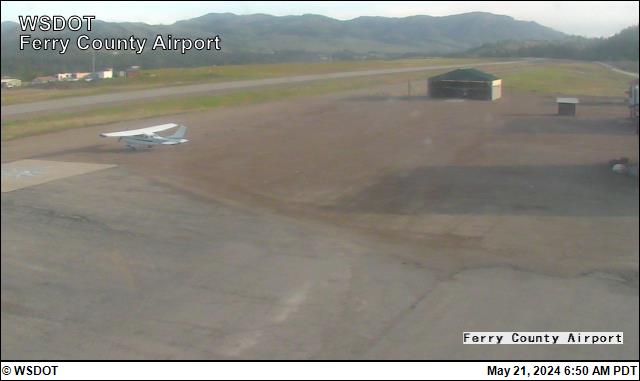
- Ferry County Airport · Washington State Department of Transportation · 7 h ago
More (1)
- Eastbound & westbound traffic is alternating on SR 542 near Twin Lakes Rd (MP 46) due to roadwork. · Washington State Department of Transportation · 22 h ago Not Yet Confirmed
The sources behind this status (11)
Sources that cover this county by name, and state or national sources that have placed records on it in the last week, by their latest read. A state-wide source that has placed nothing here is not listed.
Answered, nothing current (11)
- Washington State Department of Transportation · nothing placed on this county in its latest read · read 1 h ago
- Washington State Department of Transportation · nothing placed on this county in its latest read · read 1 h ago
- Washington State Department of Transportation · nothing placed on this county in its latest read · read 1 h ago
- Washington State Department of Transportation · nothing placed on this county in its latest read · read 10 h ago
- Washington State Department of Transportation · nothing placed on this county in its latest read · read 4 h ago
- Washington State Department of Transportation · nothing placed on this county in its latest read · read 4 h ago
- Washington State Department of Transportation · nothing placed on this county in its latest read · read 3 h ago
- Washington State Department of Transportation · nothing placed on this county in its latest read · read 5 min ago
- Washington State Department of Transportation · nothing placed on this county in its latest read · read 1 h ago
- Washington State Department of Transportation · nothing placed on this county in its latest read · read 1 h ago
- Washington State Department of Transportation · nothing placed on this county in its latest read · read 7 h ago
GovernmentQuiet17 sources answered; nothing recent here.
Government
Quiet17 sources answered; nothing recent here.
Coming Up
No meeting is on an agenda we read for the next seven days.
The sources behind this status (17)
Sources that cover this county by name, and state or national sources that have placed records on it in the last week, by their latest read. A state-wide source that has placed nothing here is not listed.
Answered, nothing current (16)
- Confederated Tribes and Bands of the Yakama Nation: Confederated Tribes and Bands of the Yakama Nation published feed · nothing placed on this county in its latest read · read Oct 27, 9:37 PM PDT
- Confederated Tribes of the Chehalis Reservation · nothing placed on this county in its latest read · read Oct 23, 7:21 AM PDT
- Cowlitz Indian Tribe · nothing placed on this county in its latest read · read 14 h ago
- Hoh Indian Tribe: Hoh Indian Tribe published feed · nothing placed on this county in its latest read · read 8 h ago
- Jamestown S'Klallam Tribe: Jamestown S'Klallam Tribe published feed · nothing placed on this county in its latest read · read Oct 22, 9:26 PM PDT
- Lower Elwha Tribal Community: Lower Elwha Tribal Community published feed · nothing placed on this county in its latest read · read 9 h ago
- Makah Indian Tribe of the Makah Indian Reservation: Makah Indian Tribe of the Makah Indian Reservation published feed · nothing placed on this county in its latest read · read 8 h ago
- Nooksack Indian Tribe: Nooksack Indian Tribe published feed · nothing placed on this county in its latest read · read 9 h ago
- Port Gamble S'Klallam Tribe: Port Gamble S'Klallam Tribe published feed · nothing placed on this county in its latest read · read 9 h ago
- Quileute Tribe of the Quileute Reservation: Quileute Tribe of the Quileute Reservation published feed · nothing placed on this county in its latest read · read 9 h ago
- Skokomish Indian Tribe: Skokomish Indian Tribe published feed · nothing placed on this county in its latest read · read 9 h ago
- Spokane Tribe of the Spokane Reservation: Spokane Tribe of the Spokane Reservation published feed · nothing placed on this county in its latest read · read 4 min ago
- Squaxin Island Tribe of the Squaxin Island Reservation: Squaxin Island Tribe of the Squaxin Island Reservation published feed · nothing placed on this county in its latest read · read 9 h ago
- Stillaguamish Tribe of Indians of Washington: Stillaguamish Tribe of Indians of Washington published feed · nothing placed on this county in its latest read · read 9 h ago
- Suquamish Indian Tribe of the Port Madison Reservation: Suquamish Indian Tribe of the Port Madison Reservation published feed · nothing placed on this county in its latest read · read 8 h ago
- Upper Skagit Indian Tribe: Upper Skagit Indian Tribe published feed · nothing placed on this county in its latest read · read Oct 27, 9:37 PM PDT
Not current (1)
- Ferry County government: Ferry County RSS · 3 records · read 9 h ago
Local NewsQuiet2 sources answered; nothing recent here.
Local News
Quiet2 sources answered; nothing recent here.
The sources behind this status (2)
Sources that cover this county by name, and state or national sources that have placed records on it in the last week, by their latest read. A state-wide source that has placed nothing here is not listed.
Answered, nothing current (2)
- The GDELT Project: GDELT 2.0 Events export · nothing placed on this county in its latest read · read 19 min ago
- Washington State Standard: Washington State Standard: state news · nothing placed on this county in its latest read · read 13 h ago
AirQuiet9 entries from USGS latest streamflow and gage height - Washington (U.S. Geological Survey) for this county, in its latest read.
Air
Quiet9 entries from USGS latest streamflow and gage height - Washington (U.S. Geological Survey) for this county, in its latest read.
- USGS latest streamflow and gage height - Washington: 9 entries for this county · U.S. Geological Survey · read 1 h ago
Entries are what each state or utility feed lists for this county: incidents, closures or outage areas. We count them; we do not reproduce them.
The sources behind this status (1)
Sources that cover this county by name, and state or national sources that have placed records on it in the last week, by their latest read. A state-wide source that has placed nothing here is not listed.
Answering with records (1)
- U.S. Geological Survey: USGS latest streamflow and gage height - Washington · 9 records placed on this county in its latest read · read 1 h ago
PowerQuietAvista: 0 customers out, within the usual daily peak in October for this county.
Power
QuietAvista: 0 customers out, within the usual daily peak in October for this county.
- Avista: 0 customers out · within the usual daily peak in October for this county · Avista · 26 min ago
- avista: 3 customers out · within the usual daily peak in October for this county · U.S. Department of Energy / Oak Ridge National Laboratory (ODIN) · 35 min ago
- Avista outage map (Kubra Storm Center): 6 entries for this county · Avista · read 26 min ago
- U.S. Department of Energy / Oak Ridge National Laboratory (ODIN) outage map (utility-built): 1 entry for this county · U.S. Department of Energy / Oak Ridge National Laboratory (ODIN) · read 35 min ago
Entries are what each state or utility feed lists for this county: incidents, closures or outage areas. We count them; we do not reproduce them.
The sources behind this status (3)
Sources that cover this county by name, and state or national sources that have placed records on it in the last week, by their latest read. A state-wide source that has placed nothing here is not listed.
Answering with records (3)
- Avista: Avista outage map (Kubra Storm Center) · 6 records placed on this county in its latest read · read 26 min ago
- U.S. Department of Energy / Oak Ridge National Laboratory (ODIN): U.S. Department of Energy / Oak Ridge National Laboratory (ODIN) outage map (utility-built) · 1 record placed on this county in its latest read · read 35 min ago
- U.S. Energy Information Administration: EIA hourly electricity demand by balancing authority · 673 records placed on this county in its latest read · read 14 h ago
HealthCan’t SeeNo source here for this.
Health
Can’t SeeNo source here for this.
Freight And EconomyQuietNothing that matters now from 4 source families here.
Freight And Economy
QuietQuiet
- Rail accidents and crossings (FRA): No reported accident or crossing collision here with a release, evacuation, injury or death in the latest data · Federal Railroad Administration · read Oct 26, 6:27 AM PDT
- Border crossings (BTS): No port here moved by a quarter against the same month a year earlier · Bureau of Transportation Statistics · read Oct 26, 6:27 AM PDT
- Gasoline prices (EIA): No weekly move of 10 cents or more · U.S. Energy Information Administration · read Oct 26, 6:27 AM PDT
Background
- Gasoline prices (EIA)
Regular gasoline, Washington, week of 2026-10-19: $5.332 a gallon, down 4 cents from the week before. U.S. Energy Information Administration - Gasoline prices (EIA)
Regular gasoline, West Coast except California, week of 2026-10-19: $5.007 a gallon, down 6 cents from the week before. U.S. Energy Information Administration - Border crossings (BTS)
Laurier (US-Canada Border), September 2026: 329 trucks. Bureau of Transportation Statistics - Border crossings (BTS)
Laurier (US-Canada Border), September 2026: 5 trains. Bureau of Transportation Statistics - Border crossings (BTS)
Laurier (US-Canada Border), September 2026: 5 train passengers. Bureau of Transportation Statistics - Border crossings (BTS)
Laurier (US-Canada Border), September 2026: 1,333 personal vehicles. Bureau of Transportation Statistics - Border crossings (BTS)
Laurier (US-Canada Border), September 2026: 2,380 personal vehicle passengers. Bureau of Transportation Statistics - Border crossings (BTS)
Ferry (US-Canada Border), September 2026: 8 trucks. Bureau of Transportation Statistics - Border crossings (BTS)
Ferry (US-Canada Border), September 2026: 1,122 personal vehicles. Bureau of Transportation Statistics - Border crossings (BTS)
Ferry (US-Canada Border), September 2026: 2,010 personal vehicle passengers. Bureau of Transportation Statistics - Border crossings (BTS)
Danville (US-Canada Border), September 2026: 7 trucks. Bureau of Transportation Statistics - Border crossings (BTS)
Danville (US-Canada Border), September 2026: 1,562 personal vehicles. Bureau of Transportation Statistics - Border crossings (BTS)
Danville (US-Canada Border), September 2026: 2,465 personal vehicle passengers. Bureau of Transportation Statistics - Border crossings (BTS)
Laurier (US-Canada Border), June 2026: 1 buses. Bureau of Transportation Statistics - Border crossings (BTS)
Laurier (US-Canada Border), June 2026: 29 bus passengers. Bureau of Transportation Statistics - Employment and wages (QCEW)
Q1 2026: 1,726 jobs (1,627 a year earlier); $1,157 average weekly wage ($1,045 a year earlier). BLS (QCEW)
Each line is the source's own fields, linked to the source. Unusual is this county against its own history, never against other counties. FRA posts about three months after an accident, so its lines are reported, not breaking. Last read: BLS (QCEW) Oct 12, 6:25 AM PDT; U.S. Energy Information Administration Oct 26, 6:27 AM PDT; Federal Railroad Administration Oct 26, 6:27 AM PDT; Bureau of Transportation Statistics Oct 26, 6:27 AM PDT.
WildlifeQuietNothing that matters now from 3 source families here.
Wildlife And Ecosystems
QuietQuiet
- Non-native species (USGS NAS): No new non-native species alert here in the last 30 days · USGS Nonindigenous Aquatic Species (NAS) · read Oct 12, 5:04 PM PDT
- Bird flu in wild birds (APHIS): No detection in wild birds here in the last 30 days · USDA APHIS · read Oct 26, 6:27 AM PDT
- Introduced species (iNaturalist): No introduced species newly recorded here · iNaturalist · read 8 min ago
Each line is the source's own fields, linked to the source. Unusual is this county against its own history, never against other counties. Bird flu detections are reported in our words with a link to USDA APHIS; its records are not reproduced. iNaturalist observations are shown only under CC0 or CC-BY, with the observer credited; others are counted. Observations with an obscured location are never placed on a county. Last read: USGS Nonindigenous Aquatic Species (NAS) Oct 12, 5:04 PM PDT; iNaturalist Oct 29, 7:26 AM PDT; USDA APHIS Oct 26, 6:27 AM PDT.
Historic PlacesQuietNothing that matters now from 3 source families here.
Historic Places
QuietQuiet
- Historic places in harm’s way: No listed place here inside an active wildfire perimeter, warning area or flood zone · National Weather Service · read 4 min ago
- National Register nominations (Federal Register): No nomination here under review · National Park Service (Federal Register) · read 33 min ago
- National Register listings (NPS): No listing or removal here in the last 30 days · National Park Service · read Oct 12, 6:25 AM PDT
Background
- National Register listings (NPS)
10 properties on the National Register in this county. National Park Service
Each line is the source's own fields, linked to the source. Sites whose location is restricted are never shown. A place inside a hazard area is our overlay of open maps, as of the hazard’s own time; it says nothing of damage. Last read: National Park Service Oct 12, 6:25 AM PDT; National Park Service (Federal Register) Oct 29, 7:00 AM PDT; National Weather Service Oct 29, 7:30 AM PDT.
River Gauges
the level now against its usual for the month4 USGS gauges · updated 5:45 AM
The level now against its usual for October (shaded, from USGS’s own record) and flood stage (red line). Not yet judged as unusual for here. Forecasts are the National Weather Service’s own, quoted.
Cameras
Public cameras in the county
Camera unavailable right now

Camera unavailable right now

Camera unavailable right now

Camera unavailable right now

Camera unavailable right now

Camera unavailable right now
Stills are our copies, read from each camera’s owner while this page is open, with the owner’s credit. Cameras whose owners do not allow a copy are linked.
Events · No event in this county met our bar to publish in this window.